Mt Paektu Geopark
Introduction
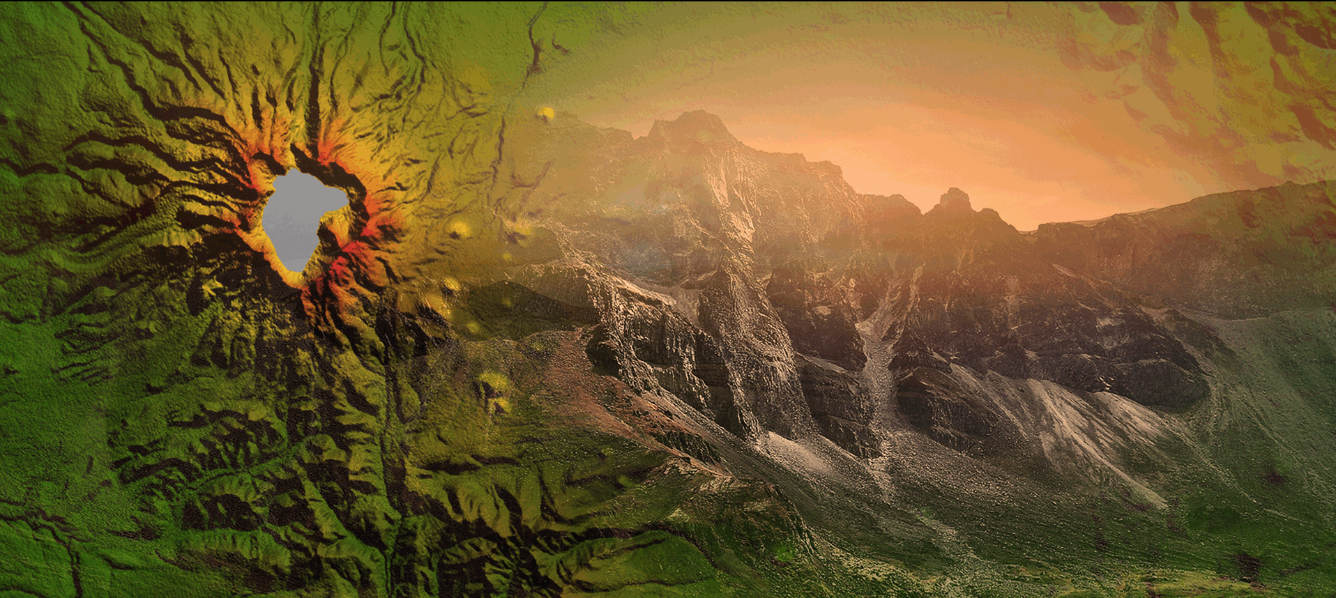
Mt Paektu Geopark embraces Mt Paektu, the highest mountain (2 750m) in the Democratic People’s Republic of Korea.
Mt Paektu is the ancestral mountain associated with the soul of the Korean nation with a history spanning 5 000 years, and the sacred mountain of the revolution representative of the spirit and stamina of Korea.
Natural elements in the mountain, such as volcano-related geology and landforms, flora and fauna combined with the natural environment of highlands, hydrological regime originated from Lake Chon and soil formed in correlation with pumice ejection and alpine vegetation, are changing constantly in a unique environment which is not found in other parts of the country.
Mt Paektu Geopark is a geological research and dissemination centre and also a tourist resort where many sites of geological significance and tourist value are distributed on a certain scale.
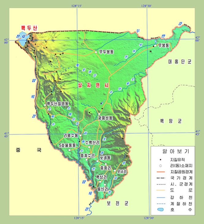
Mt Paektu Geopark is located in Samjiyon, Ryanggang Province of the Democratic People’s Republic of Korea.
The geopark is identical with the administrative division of the city of Samjiyon. This area is a large volcanic zone formed by volcanic eruptions that had started since the Neogene.
The geopark is one of the places featured by the lowest temperature and the most volatile weather patterns in the country.
The area boasts high sea level, typical alpine weather and various glacial terrains.
Geosites
Volcanic Body and Volcanoes
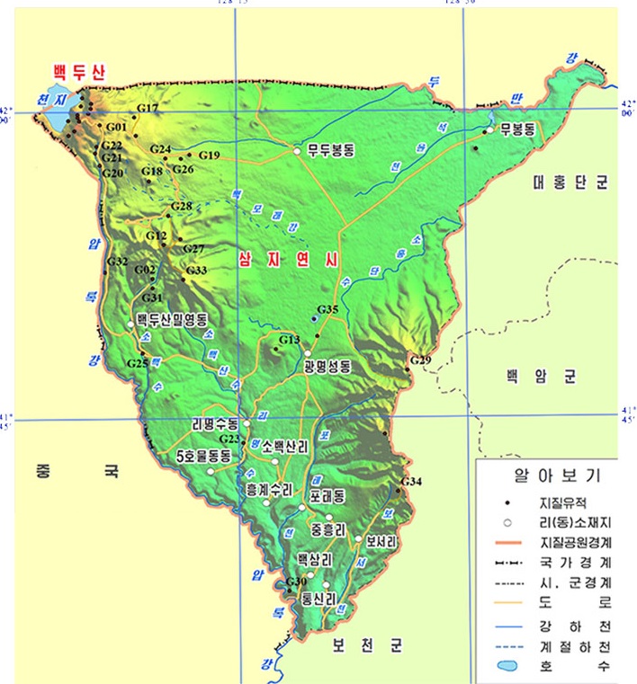
- Mt Paektu Volcano G01
- Jong Il Peak G02
- Hyangdo Peak Volcano G07
- Tangyol Peak Volcano G08
- Haeppal Peak Volcano G09
- Ssangmujigae Peak Volcano G10
- Mt Kanbaek Volcano G12
- Pegae Peak Volcano G13
- Soyonji Peak Parasitic Volcano G18
- Mudu Peak Parasitic Volcano G19
Geologic Sections
- Geologic Section at Kat Peak G11
- Geologic Section near Paektu Bridge G17
- Geologic Section at Paeksam-ri G30
- Columnar Jointing at Poso-ri G34
Volcanic Necks
- Volcanic Neck No. 1 (Piru Peak) G04
- Volcanic Neck No. 2 G05
- Volcanic Neck No. 3 G06
Mysterious Rocks
- Laccolith at Janggun Peak G03
- Volcanic Bombs G26
- Mysterious Rocks in Mt Jungam G27
- “Salty” Rocks in Mt Kanbaek G28
- Lava Rocks in Mt Pukphothae G29
- Ryongma Rocks G31
- Chongun Rocks G32
- Mysterious Rocks in Mt Sobaek G33
Hydrological Geosites
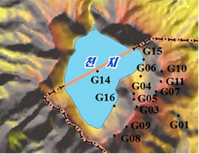
- Lake Chon G14
- Sandy Beach of Lake Chon G15
- Paektu Hot Spring G16
- Hyongje Falls G20
- Paektu Falls G21
- Sagimun Falls G22
- Rimyongsu Falls G23
- Lake Samji G35
Products of Volcanic Disasters
- Buried Trees G24
- Carbonized Trees G25
Natural Scenery
Mt Paektu Geopark boasts spectacular natural scenes as it has rare alpine volcanic landforms, rich fauna and flora and changeable weather patterns.